
It begins!
2 days of driving to go from Vancouver to Waterton Lakes National Park in Alberta. Very scenic drive along highway 3. Big thanks to Viv's mum for getting us here!
First 2 nights (yesterday night and tonight) in the frontcountry campsite in town. There are lots of screaming babies and little ground squirrels, but the views are amazing!
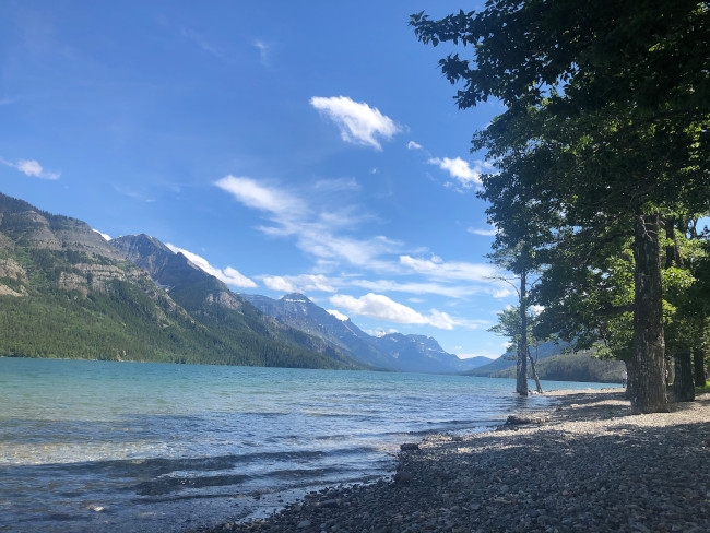
The view from the town.
Day 1 - Touching the border
11km
Today (July 7) was officially the start of our hike. It's a short ~11km hike there-and-back to the border. There's not much there, but there are signs telling you how to do customs if you cross over, and warning you not to bring drugs. On the US side is Glacier National Park. We met some folks who were visiting Waterton but work in Glacier, and they pointed out some of the peaks. The prominent mountain with a band of snow almost at the top in the picture above (left of the lake, a bit in the background) is called Cleveland, and is the highest peak in Montana. Apparently Glacier park gets 3 million visitors per year!

Deer on the trail. Not very worried about us.
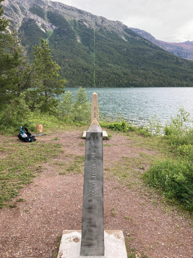
The border!
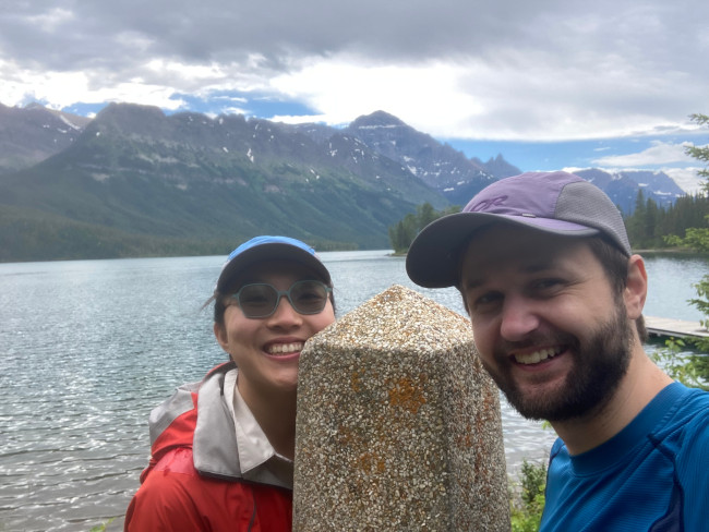
Us at the border monument.
We celebrated with waffles in Waterton (place called Waffleton). The first leg quickly gets serious, but we're feeling good and weather looks great. First resupply (and a zero day!) is at Coleman in 5 days.
Day 2 - Waterton to Akamina
23.6km, 1339m ascent
Brilliant day of hiking through several alpine lakes. The whistle pigs of the Rockies are HUGE!! Met other GDT hikers at the campsite and felt a lot less crazy. Got some good info on the trail ahead from a group doing the section southbound.
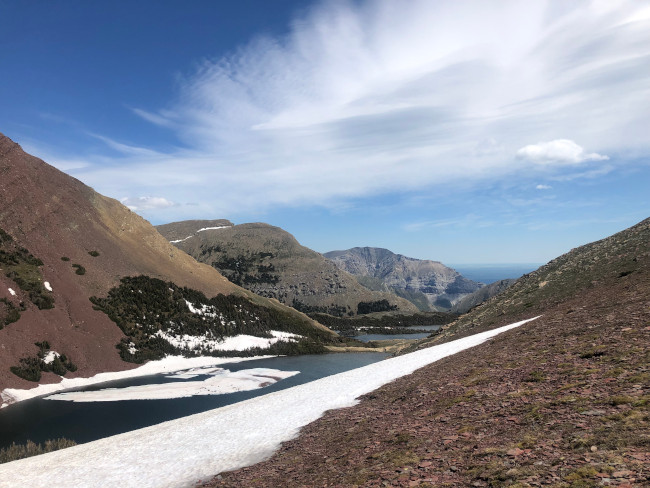
Pretty amazing alpine lakes.
Mountain views.
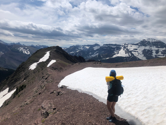
Day 3 - Mt Rowe Alternate Route
20.4km, 1743m ascent
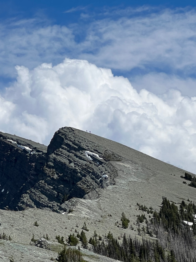
The main GDT route, the Tamarack Trail, was inaccessible due to too much snow cover so we decided (quite willingly) to tackle the high alpine alternate route instead. This was by far the hardest day we've ever backpacked. Started with a climb to Rowe Peak where we met a mama moose (cool!!) with two mooselettes (uhohhh!). The rest of the trail consisted of countless ups and downs along Rowe Ridge - the ridge goes up and right in picture below. It took several summits before we could even see our final pass. There was intense scree scrambling, cliff dodging, ridge hiking, route finding, and snow hiking. It was only ~20km but took us 13h (7am - 8pm) with few breaks. Definitely some of the most hardcore type 2 fun we've ever experienced. Epic views into BC and Alberta all day.
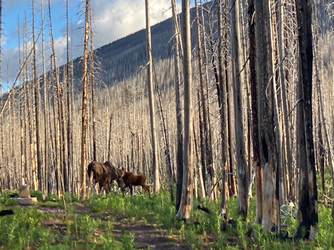
Moose!
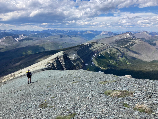
We hiked along the ridge basically all day. You cannot see the final pass in this photo. This ridge is the divide, and so is the BC-Alberta border.
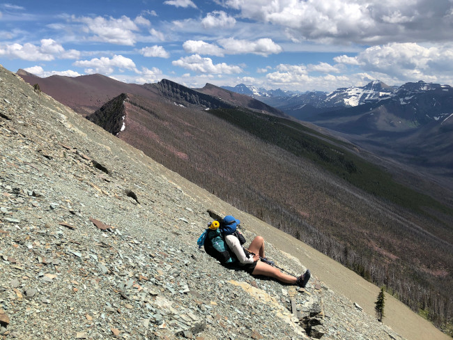
Viv resting in a very tiring scree field traverse on Mt Festubert.
You can just about see us in the distance.
Still a significant amount of snow in places.
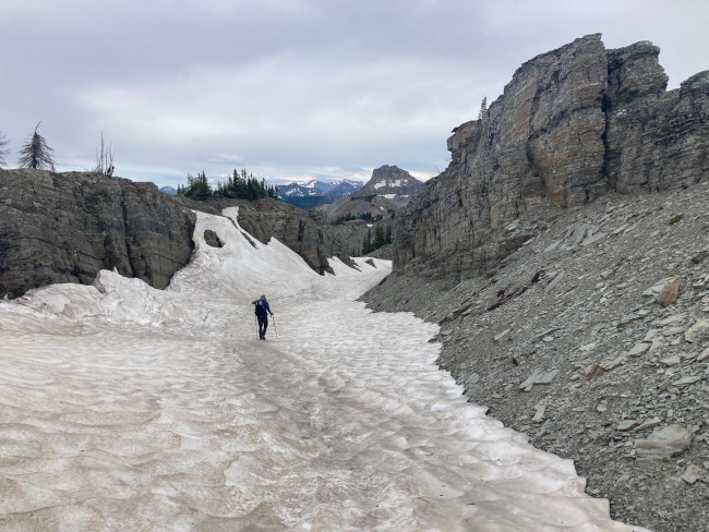
Day 4 - Snow Hell
15.0km, 759m
We continued along the ridge, skirting along various summits. The ridge's direction changed to running more west-east. This, in addition to the lower elevation (more trees), meant intense snow build up on the northern side of the ridge. This meant snow covered paths, lots of avalanche debris, and very hard rough route finding. A low moment for us was when we arrived at the last campsite before the La Coulette ascent at 2:30 PM and decided to not proceed because the next campsite was several kms through the strenuous Coulette Ridge. This turned out to be a fantastic decision because we actually got to rest and nap while our GDT friend Alex built us a giant fire. This also was a great decision because of how hard the next day was.
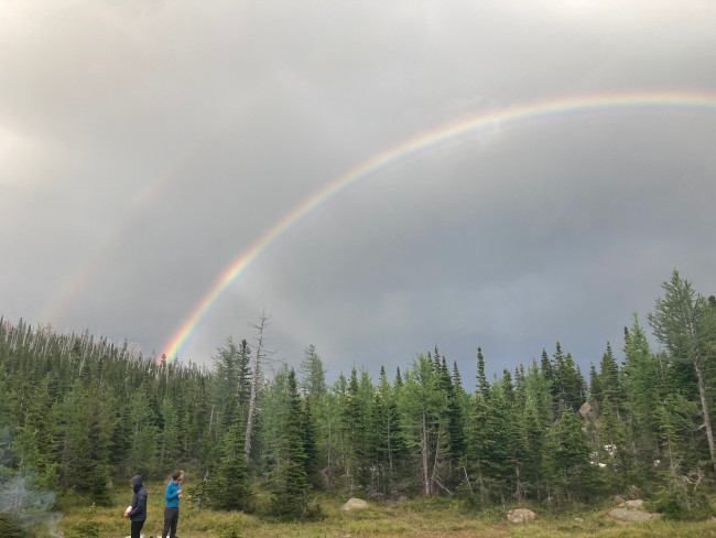
Double rainbow!
Day 5 - La Coullette
26.7km, 1233m
Hiking through the La Coulette ridge and peak took many hours. Had we continued the day before, we would have arrived at the first campsite at midnight. Despite it being the most challening terrain of this section, La Coulette actually felt like a breeze compared to Rowe Ridge. Similarly to Rowe, this route is not for the faint of heart. Realizing we couldn't get into Coleman on time in the next two days, we decided to push 15km more to Castle Hostel where Daphne, our amazing trail manager, secured us a room and a ride out to Coleman the next day. We're skipping about 51km of this section, but it is mostly road walking, so we aren't torn up about it.
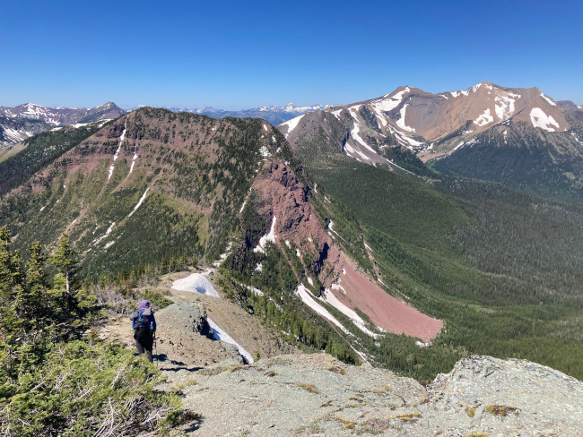
We had to go up (and then down) that red ridge.
Day 6 - Zero!!
Vivian has never felt more appreciative of her feet.
We woke up at 7 and proceeded to sleep more. We had leftover chocolate for breakfast and hung around in the shade until a giant group from the Piikani Nation of the Blackfoot Confederacy invited us to have lunch with them - best indian tacos ever.
Now we continue to appreciate our feet by sitting and revising our itenerary for the next section. Section B is Coleman to Peter Lougheed Provincial Park, and includes the original ~100 stretch of the GDT, created in the 1970s. Our resupply will not have signal or wifi, so next update will probably be after section C - which goes through Banff, Yoho, Assiniboine, Kootenay, and other parks. Each of these sections is 7 days.
Tomorrow is another zero day in Coleman, and then back at it.